 by
by Southern Michigan was bracing for a possible ice storm, but the latest weather updates show a change in the forecast. The weather system, which was expected to bring freezing rain and snow to the area, is weakening, meaning the risk of ice accumulation is much lower. However, travel could still be tricky early Thursday morning, especially in the southeast parts of the state. Let’s break down the details of what to expect over the next few days.
The Weather Forecast: What’s Changed?
The weather system heading toward Michigan this week was initially expected to bring a significant amount of freezing rain. At first, experts warned that there could be up to one-quarter inch of ice in some areas, which could cause hazardous conditions on the roads.
But now, the forecast has shifted. The system is splitting into two parts, one heading across the Upper Peninsula and the other over Indiana and Ohio. This means that the freezing rain in southern Michigan will be much lighter than originally predicted. There’s still a chance of light snow and freezing rain Wednesday night into Thursday morning, but the overall impact will be less than expected.
What to Expect: Snow and Ice, But Not Much
The updated forecast suggests that light snow and freezing rain will start Wednesday night and continue until around mid-morning Thursday. The southern half of Lower Michigan might see only about 1 to 2 inches of snow, while the northern part of Lower Michigan could see up to 3 inches.
The good news is that the freezing rain accumulation will likely stay well below one-tenth of an inch in southern Michigan. In fact, some areas may only see a few hundredths of an inch. So, while it will still be slippery in some places, it won’t be as dangerous as initially thought.
How Will the Weather Affect Travel?
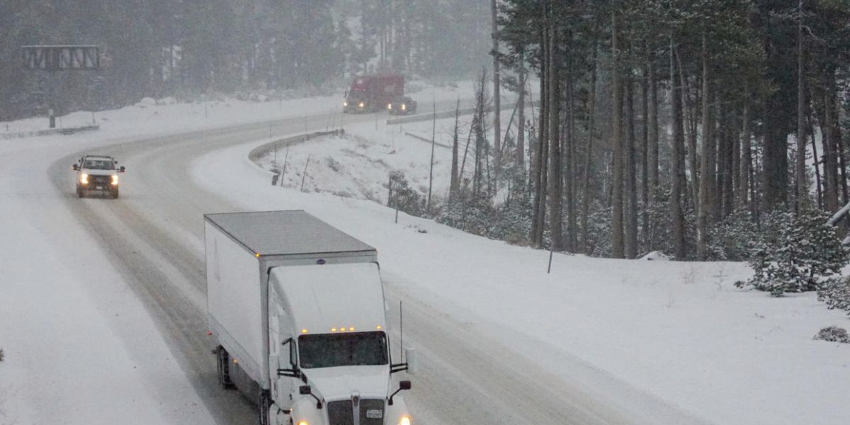
Even though the ice buildup will be lighter than expected, it could still make the roads slick, especially early Thursday morning. If you need to drive, be cautious, particularly if you’re in the southeast part of Lower Michigan, including cities like Detroit and Ann Arbor. The freezing rain could cause a thin layer of ice on the roads, which can be very slippery.
If possible, delay your travel until late morning or early afternoon. By then, temperatures will rise above freezing, and any ice on the roads should melt away. This will give road crews time to treat the highways and interstates with salt, making conditions safer for drivers.
What’s Next: A Warm-Up
The good news doesn’t stop there. Starting around noon Thursday, the temperatures will begin to rise, bringing warmer air into the region. This means that any ice on the roads will start to melt naturally. By the afternoon, the risk of freezing rain will be gone, and conditions will improve significantly.
If you’re worried about road conditions on Thursday morning, it’s best to plan for some delays. As temperatures warm up, any lingering ice will melt, and driving should become easier. However, it’s still a good idea to keep an eye on the weather updates as they can change quickly.
Key Takeaways:
- The weather system heading toward Michigan has weakened, so the risk of freezing rain and ice accumulation is much lower than expected.
- Light snow and freezing rain will still affect the region, but accumulation should be minimal.
- The southeast part of Lower Michigan (including Detroit and Ann Arbor) may have slick roads early Thursday morning.
- Temperatures will rise above freezing by noon Thursday, melting any ice and improving driving conditions.
(Source : mlive.com)