 by
by A First Alert Weather Day is in place for tonight, as strong storms are expected to move through central Mississippi. These storms will begin later this evening and could last into the early hours of Friday morning. The storms will bring a mix of heavy rain, high winds, and the possibility of flash flooding. The most likely time for the storms to affect the area is from 6:00 PM Thursday to 1:00 AM Friday, although not every area will see storms throughout that entire period.
Key Storm Risks: Strong Winds and Flash Flooding
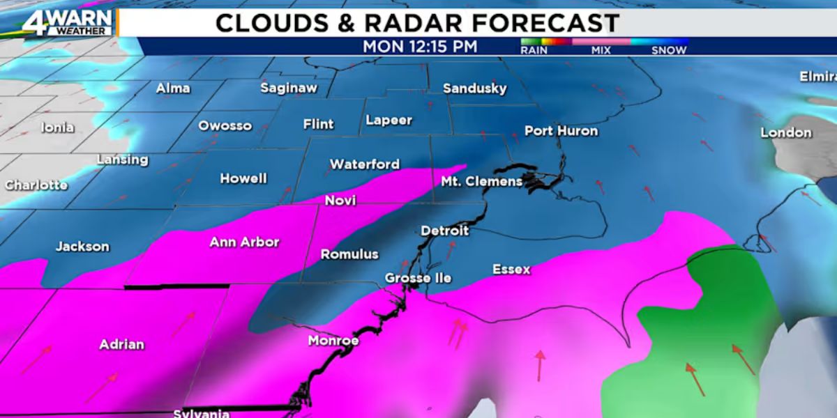
Timing and Area Affected:
The storms will first hit western Mississippi around 6:00 PM. As the evening progresses, they will move eastward and should reach the I-55 corridor around 11:00 PM. By 1:00 AM Friday, the storms will have passed through, leaving clearer skies behind.
Main Threats:
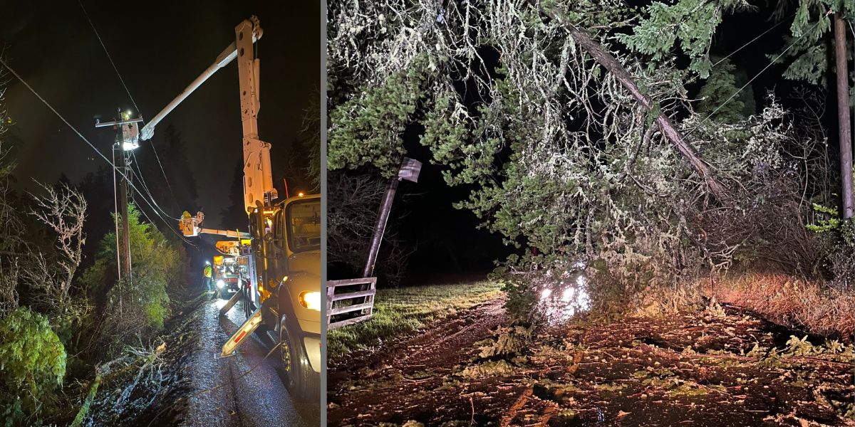
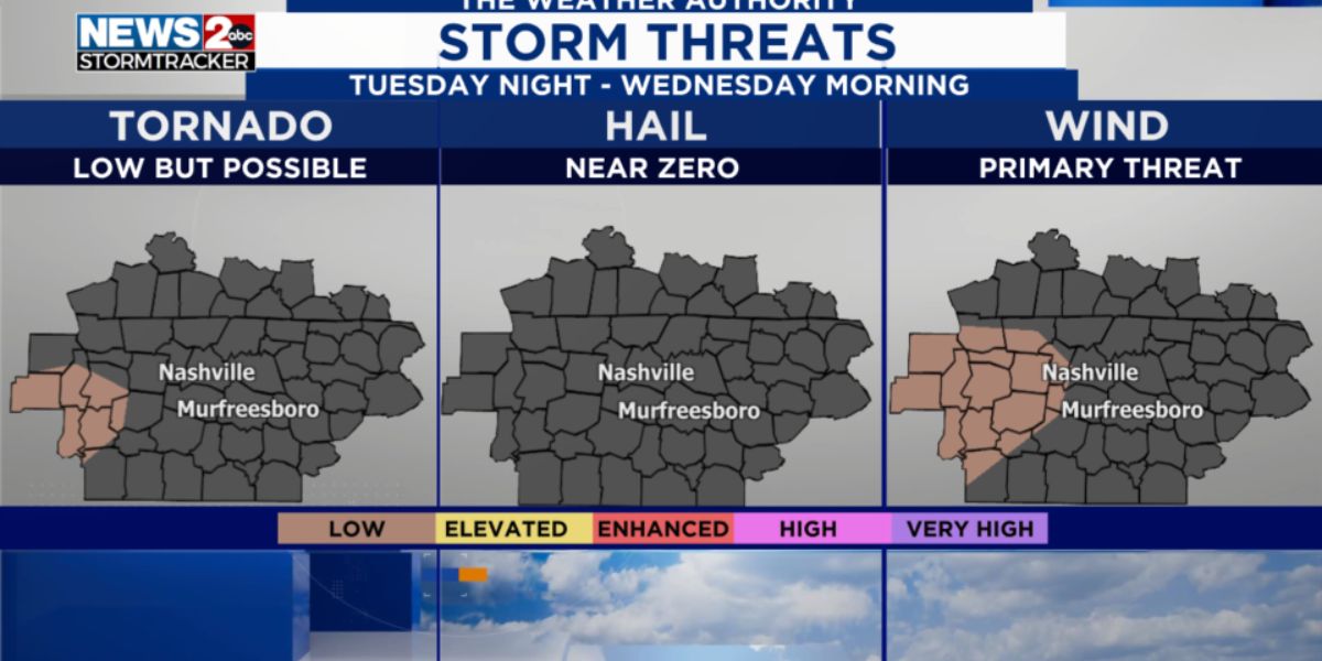
- Damaging Winds: The primary concern with these storms is the risk of strong wind gusts. Winds could cause tree damage and power outages.
- Flash Flooding: Some areas may experience localized flooding due to heavy rain. Drivers are advised to be cautious on roads, especially in low-lying areas that could flood quickly.
- Low Tornado Risk: While tornadoes are unlikely, there is still a small chance. So, it’s essential to stay alert and have ways to receive weather updates, especially at night.
Weather Conditions After the Storms
Friday Morning:
Once the storms move out early Friday, the weather will improve dramatically. Expect dry and windy conditions for the rest of the day. Temperatures will still be well above normal, reaching the low 70s and upper 60s in the afternoon. It will be a bit breezy, with wind gusts potentially making it feel cooler.
Evening Forecast:
As the day transitions to night, temperatures will drop into the 40s after sunset. However, the skies will remain partly cloudy, and the weather should stay calm and clear.
Weekend Weather Outlook: Pleasant and Mild
Looking ahead to the weekend, conditions will be much calmer and more enjoyable. Saturday and Sunday will feature mostly sunny skies, with temperatures hovering in the middle 60s to low 70s during the afternoon. It will be the perfect weather for outdoor activities, with clear skies and mild temperatures.
Extended Forecast:
The pleasant weather will continue into next week. With temperatures staying above average, the area will remain dry, with only a small chance of rain toward the end of the week.
Weather Tips for Thursday Night into Friday
As severe weather approaches, it’s important to be prepared and stay safe. Here are some tips:
- Stay Weather-Aware: Keep track of the weather updates and alerts. The storms may come quickly, so be prepared to act if necessary.
- Secure Loose Objects: High winds could cause damage, so secure outdoor furniture, trash cans, and other items that could be blown away.
- Avoid Driving in Heavy Rain: If you don’t need to be on the roads, it’s safer to stay home during the storms. If you must drive, avoid flooded areas and slow down.
- Have an Emergency Kit Ready: It’s always a good idea to have essentials like flashlights, batteries, and first-aid supplies in case of power outages.
(Source : wlbt.com)