 by
by Sacramento, CA – Northern California is in for a wet and foggy weekend as a storm system brings heavy rain, dense fog, and the potential for travel disruptions. With widespread rainfall expected through Sunday, drivers are advised to stay cautious on the roads, especially on highways like I-80 and Highway 50, which could be slippery and difficult to navigate.
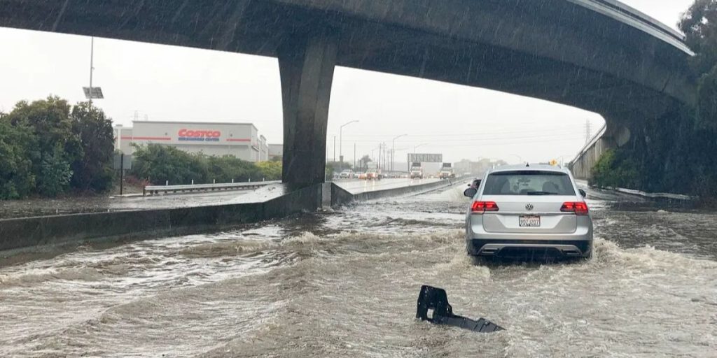
According to the National Weather Service, the heavy rain will begin this afternoon and continue into Sunday morning. A quarter inch of rain is expected in many areas, creating slippery roads and poor visibility. Dense fog is also a concern, particularly for drivers in low-lying areas. Officials are urging motorists to slow down, use their headlights, and leave extra space between vehicles to avoid accidents in these hazardous conditions.
As the rain continues into the evening, patchy fog is expected to roll in, with lingering showers throughout the night. Drivers should remain alert as visibility will be low, and conditions could change quickly. The National Weather Service is also cautioning residents to avoid unnecessary travel during peak storm hours, as the weather could make getting around difficult.
On Sunday, the rain may briefly subside, but conditions will worsen again by Sunday night. A major storm system is expected to arrive on Monday evening, bringing more heavy rain and isolated thunderstorms. The storm will likely intensify overnight, with gusty winds causing additional travel challenges. Wind speeds could reach up to 40 mph in some areas, making driving dangerous, particularly in open spaces and along high bridges.
By Christmas Eve, the storm is forecast to peak, with widespread rainfall and strong winds affecting much of the region. The National Weather Service has issued warnings for areas that will experience gusty winds, making travel conditions particularly hazardous in the foothills and mountainous regions. Snow levels are expected to drop as low as 3,000 feet by midweek, which could create additional travel problems in higher elevations.
While the storm will continue to make travel difficult, Christmas Day offers a brief respite. The weather is expected to clear, with partly sunny skies and temperatures reaching around 54°F. This will give residents a chance to enjoy some holiday activities outdoors. However, intermittent showers may return later in the week, so travelers should keep an eye on the forecast as they head into the new year.
For those heading out this weekend, it’s important to take a few precautions. The National Weather Service recommends securing outdoor decorations and furniture ahead of high winds, as they could be knocked over or blown away. Those who don’t need to be out on the roads should consider staying home, especially during the storm’s peak times, to avoid unnecessary risk.
Travelers should also check for traffic updates and road closures before hitting the road. With the heavy rain and fog, driving conditions are likely to be challenging, and delays are possible. Areas along the coast and in the mountains may see more severe impacts, with possible flooding and snow.